Cincinnati Earthworks GIS (33HA1)
Choose your basemap, Select + or - to zoom, Use mouse or finger to move
Timeline
100 BCE-400 CE
Formation of the Earthworks
The Earthworks were built likely in the Middle woodland period sometime between 100 BCE and 400 CE.
100 BCE-400 CE
1788
Cincinnati was founded
Cincinnati was founded December 1788 and the Earthworks began to be explored as a curiosity leading to reduction in size and destruction.
1793
Cincinnati Mound truncation
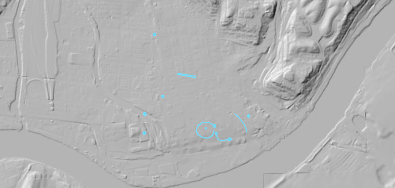
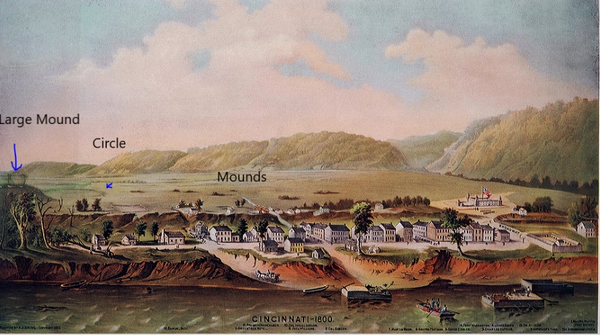
General Wayne had his army cut off the summit of the Mound closest to Fort Washington and the town in order to erect a sentry-box on top of it. After the top was removed the mound was 35' tall. This mound can be seen in the 1800 painting of Cincinnati as the large mound to the left of the town. The Cincinnati Tablet (Squier and Davis P275 see below) was found in one of these mounds.
1793
1815
Daniel Drake
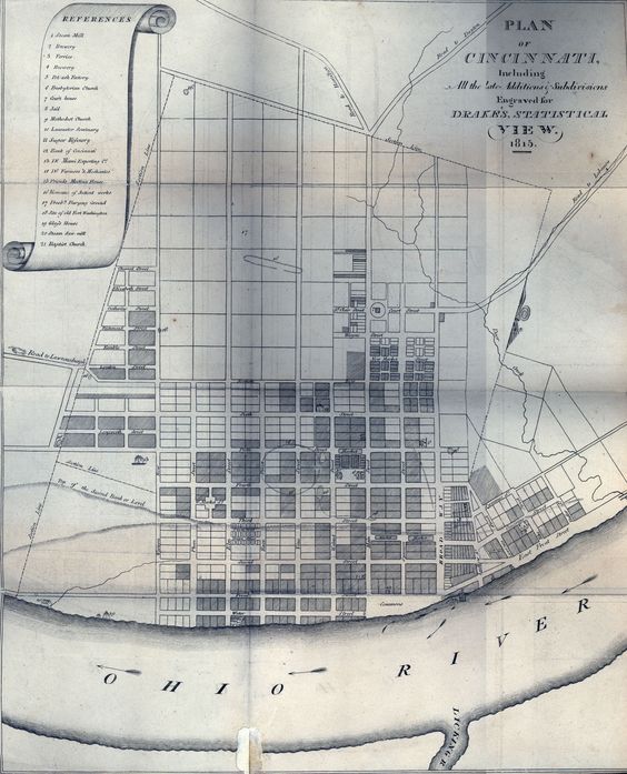
1815 Daniel Drake's book gives a detailed discription and drawing of what was still left of the Cincinnati Earthworks after the exploring and digging of the earthworks by curious settlers and visitors of Cincinnati.
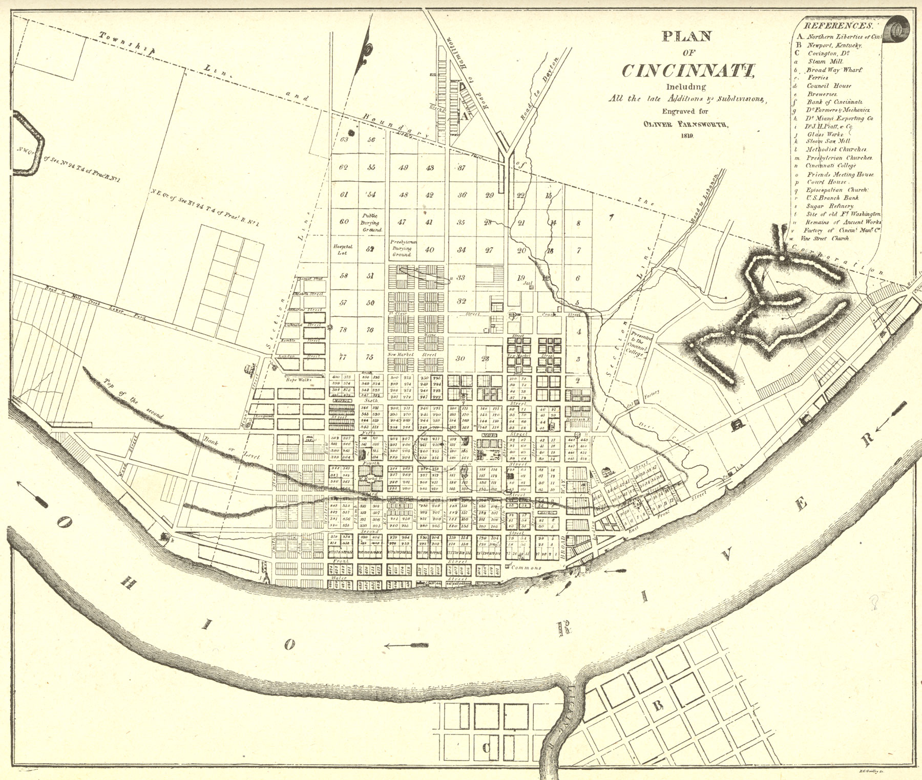
1819
1819 Map
1819
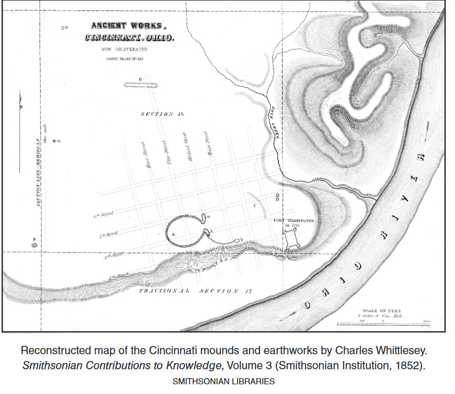
1852
Charles Whittlesely recreates a drawing of Cincinnati Earthworks for Smithsonian Contributions of Knowledge volume 3.
Daniel Drake 1815
Natural and Statistical View; Or Picture of Cincinnati and the Miami Country
Miami Fort
Colrain
Butler Co Circle
Pleasent Run
Fortified Hill
Line Hill
Alexandersville
Cincinnati
Mariemont
Turner Group
Camden
Milford
Fosters
Stubbs
Fort Ancient
Perintown
Stonelick
Batavia
Elklick
Eastfork
Colrain
Butler Co Circle
Pleasent Run
Fortified Hill
Line Hill
Alexandersville
Cincinnati
Mariemont
Turner Group
Camden
Milford
Fosters
Stubbs
Fort Ancient
Perintown
Stonelick
Batavia
Elklick
Eastfork
